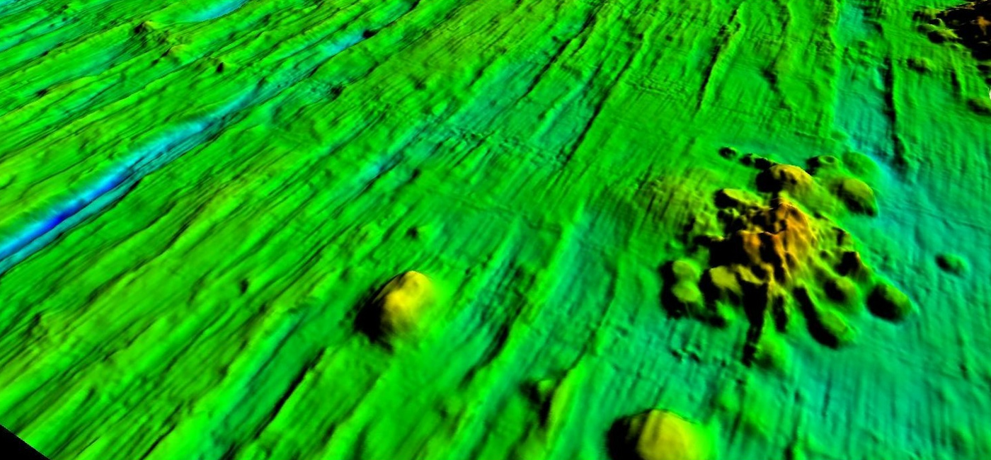
From multibeamechosounding a bathymetric image and a backscattered signal image can be derived. The IOM area is represented by raised and immersed blocks, deep troughs, strictly north-south oriented. Backscattered signal helps to determine basement outcrops, volcanoes, nodule fields and nodule free areas. IOM conducted a bathymetric mapping of the whole exploration area (B1 and B2 sectors). On that basis a relief map of the ocean bottom in 1:200,000 scale was prepared. The bottom surface of the IOM area is located in the depth range 2,450 – 4,750 m below the sea level. The morphological structure of the ocean bottom has been formed by volcanic and tectonic activity during the Oligocene and Miocene periods (34 to 5 million years ago).
3D projection of deep seabed in the IOM exploration area (sector B2).
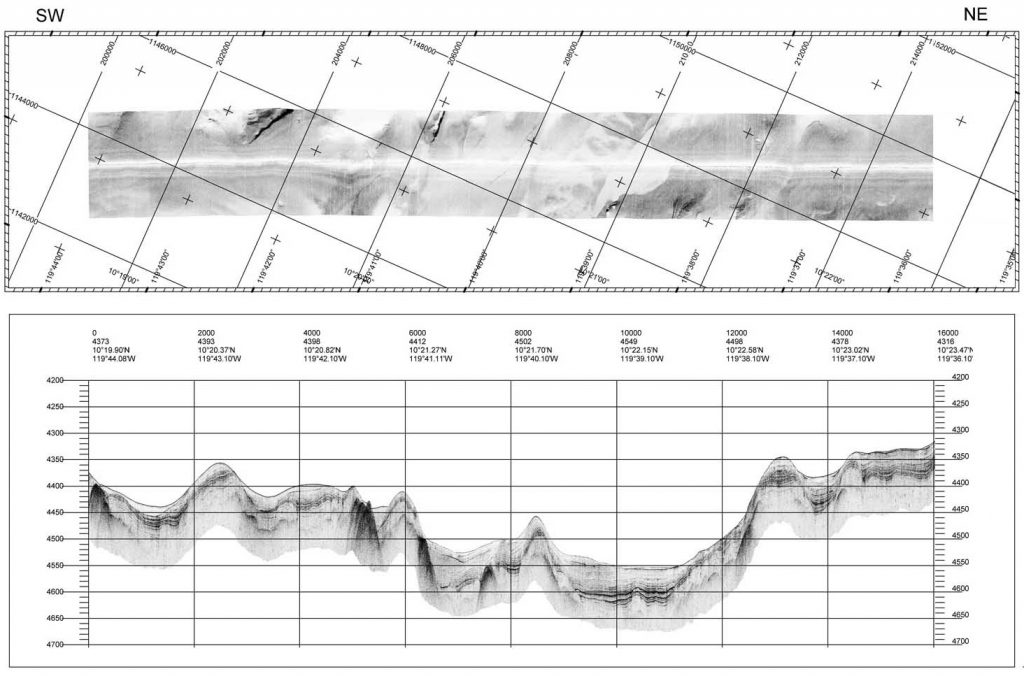
Side-scan and sub-bottom profiling
For creation of an image of large seabed areas, side-scan sonar system is used. It scans an area of 2 km wide (creating 2 strips, each of 1 km width). Side-scan data is received along with sub-bottom profiler data, providing a view of the shallow structure of the seabed. Profiler has a capacity to penetrate the sedimentary cover down to 150 m. Sonar device is towed from a research vessel, 80-120 m above the seabed.
Device for side scan and sub bottom profiling.
Image of seabed surface (above) and sub-bottom profile (below).
Photo profiling
Photo-profiling (photo and video) provides data on sea bottom morphology, nodule abundance, type, continuity of nodule coverage and mega-fauna occurrences. A photo-profiling device is towed from a research vessel, approximately 4 m above the seabed.
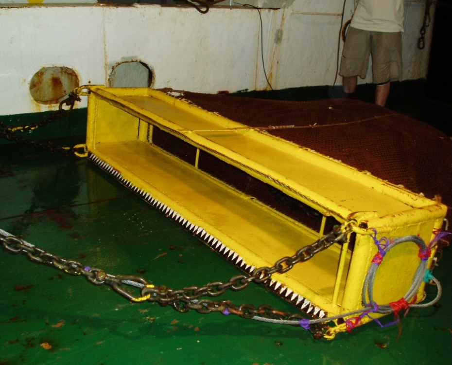
Trawling device for collection of large-scale samples.
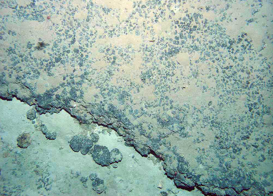
Photographs provide plenty of information on sea bottom characteristics.
Box corer sampling
Polymetallic nodules, bottom sediments and fauna samples are collected using a box corer. The device has a capture area of 0.25 m2 (0.5 x 0.5 m) and is equipped with a deep-water photographic system. The lowering and raising operations are carried out with the usage of a winch with a tackle, fitted with a steel three-strand rope of 14 mm diameter, which goes through an aft gantry. The distance between the device and the bottom is determined by an acoustic pinger signal.
Box corer with seabed sample lifted on board.
Localization of stations (sampling points) in the IOM exploration area.
Box corer seabed sample.
Trawling and dredging
Trawling is used for a large-volume nodule sample collection, using a trawl of 40 х 140 cm in dimension. In order to collect nodules, a basket of the general capacity of about 1000 kg and length of 2 m, made of polyamide fabric, is attached to the body of the trawl. Dredging is used to sample hard rock type of seabed (basalts), using a dredge – a 1 m long and 0.8 m in diameter cylinder-like sampler. Devices are towed from a research vessel.
Trawling device for collection of large-scale samples.
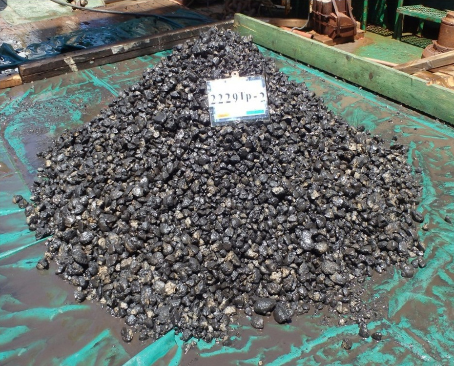
Large-scale sample.
Geological and geotechnical research
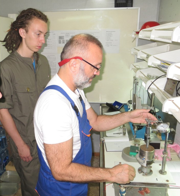
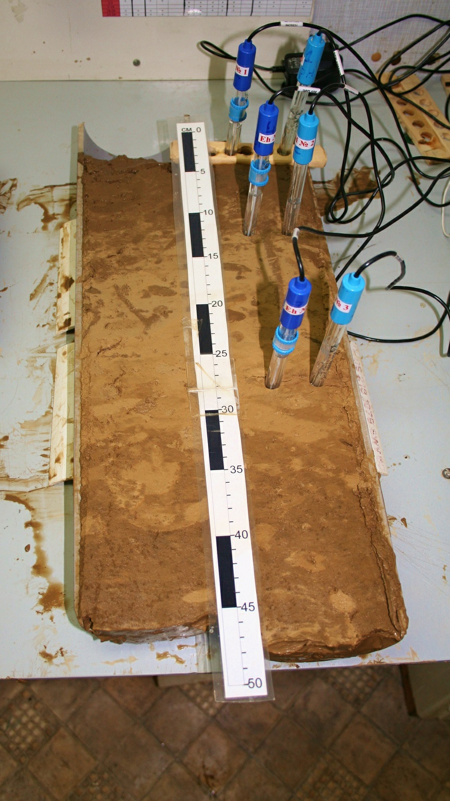
The sedimentary cover of the eastern part of the CCZ consists of well distinguished facies of nano-fossil carbonates, red pelagic clays and siliceous clays. The bottom sediments within the IOM exploration area are divided into litho-stratigraphic units, based on their origin and composition. The sedimentary cover within the IOM exploration area does not exceed 100 meters. The top 1 to 15 cm layer comprises the geochemically active layer, which is the environment for nodule formation. Based on the results of geo-acoustic profiling including high resolution side-scan sonar, photo and video profiling as well as analysis of sediment samples, several geotechnical strata were identified. Geotechnical measurements of physical, mechanical and technological properties of the sediment (water content, volumetric density, vane shear strength, penetration resistance) and of polymetallic nodules (water content, volumetric density, compressive strength, rip-off force resistance, nodule apparent density, angle of repose) are carried out on-board on a research vessel and in on-land laboratories.
On board geotechnical research.
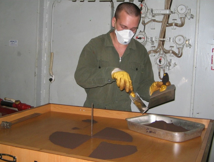
Polymetallic nodule sample preparation (grinding and quartering).
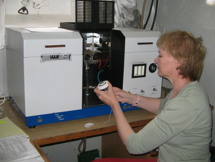
Primary chemical analysis and determination of metal content is performed on board.